Long weekends are meant to be used well, and as the May 1st holiday of 2025 (International Labour Day) approached, we found ourselves scouting for the best places to visit in Ireland. This island has long been on our radar for its emerald hills, dramatic coastlines, and lush forests. After some browsing, we put together a four-day road trip itinerary that would allow us to soak in Ireland’s beauty and wild nature.
Ireland Trip Duration and Costs
- Transport: By car
- Duration: 4 days
- Arrival/Departure Airport: Dublin International (DUB)
- Car Rental: The cheapest option found – Europcar.
Price for 4 days: €162 (automatic transmission).
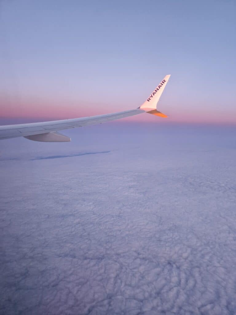
Important: A credit card is required for the car rental. - Flight Tickets: Ryanair. We flew out on Wednesday evening and returned on Sunday.
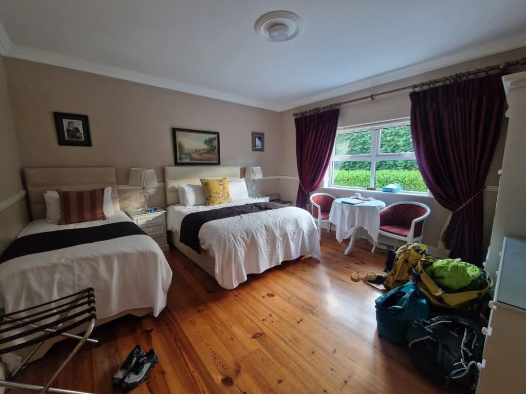
Price per person (round trip): €160. - First Night’s Stay: Dublin, Warm Welcome Rooms. We chose an affordable spot close to the airport for the first night. Self-check-in: ✓, Breakfast: ✓.
Price for one night (double): €70.
Day 1: Places to Visit in Ireland, County Donegal
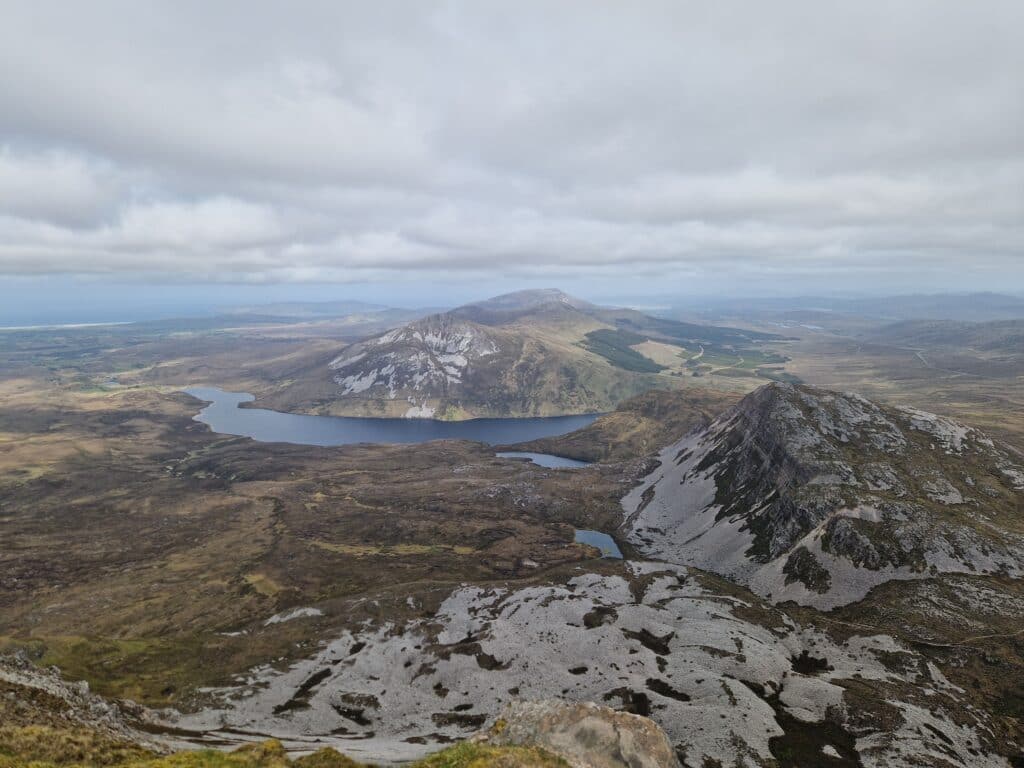
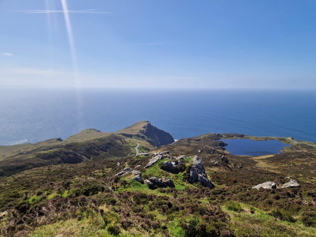
The Seven Sisters: Climbing Mount Errigal
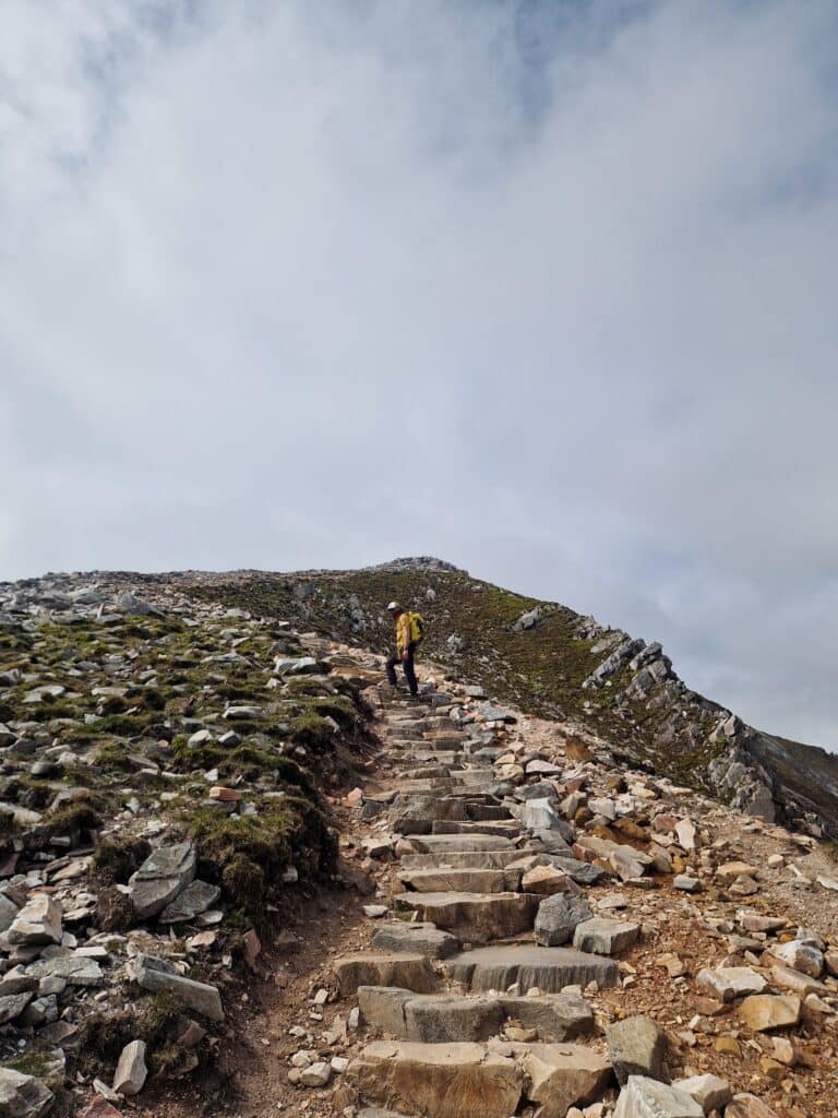
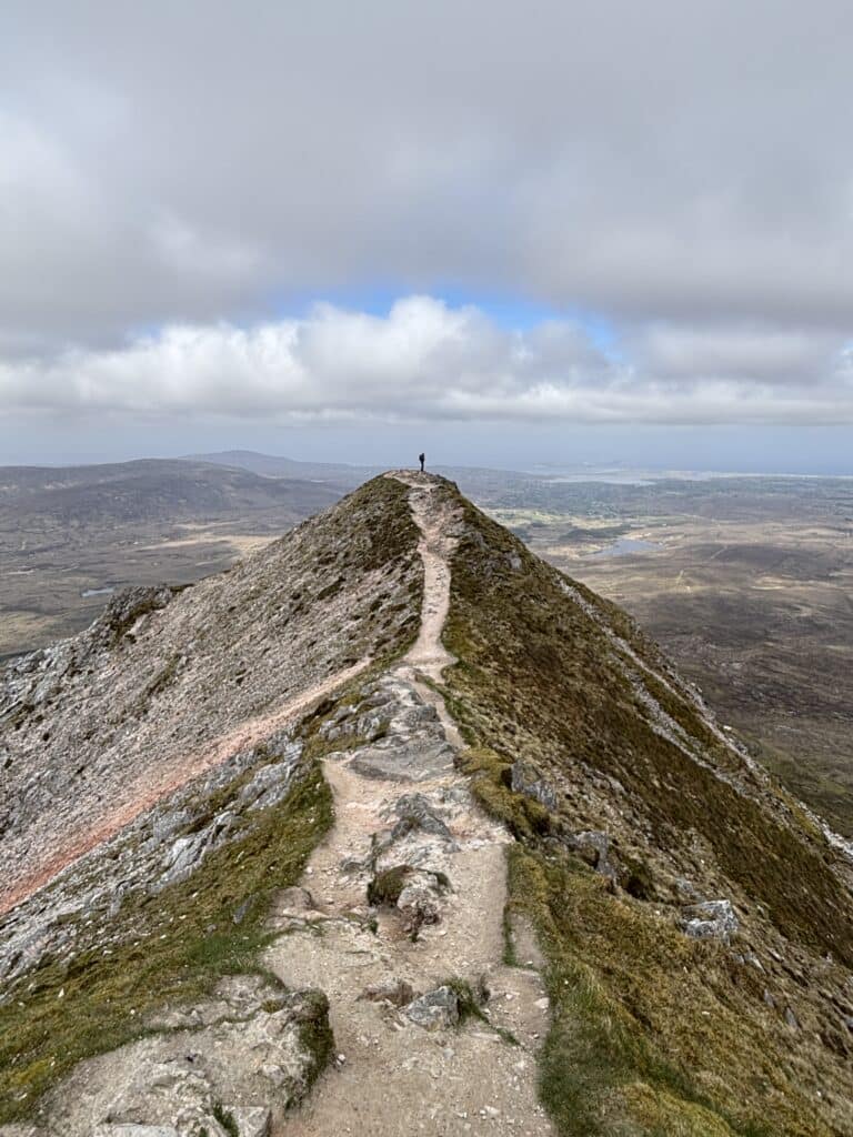
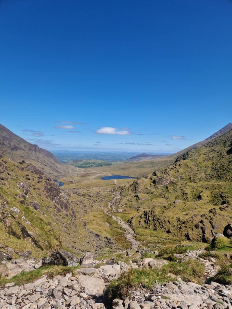
We began our weekend trip by heading toward County Donegal in the northwest of the island. While searching for beautiful nature spots here, we discovered the “Seven Sisters” located in the Derryveagh Mountains. They consist of seven beautiful hills, the most famous of which is Errigal, reaching 751 meters. The other peaks are Mackoght (551m), Aghla More (581m), Ardloughnabrackbaddy (603m), Aghla Beg (564m), Crocknalaragagh (471m), and Muckish (666m). Together, these peaks form one of the most scenic 21km routes—the Seven Sisters Skyline.
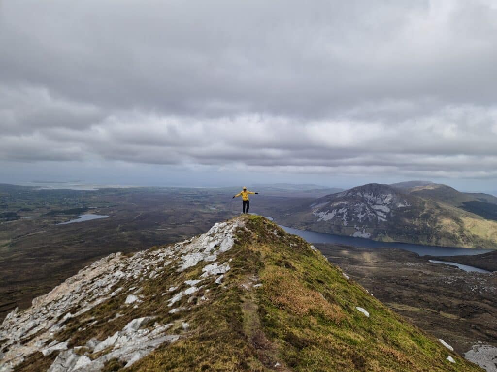
Initially, we planned to run across all seven peaks, but due to logistical challenges (the route is not a loop), we decided to climb one and see how we felt. We chose the most beautiful—Errigal. We left the car in the parking lot near the mountain, swapped into our hiking boots, and set off. The trail is very easy and well-marked, so we ascended quickly. The higher we climbed, the more spectacular the views became. The summit itself proved to be incredibly photogenic!
You can head back down via the same path or take the other side of the mountain. We chose the other side. It is significantly more difficult as it leads down a scree slope that requires more focus. The best part of the descent was that we didn’t meet a single soul! We had the mountain all to ourselves!
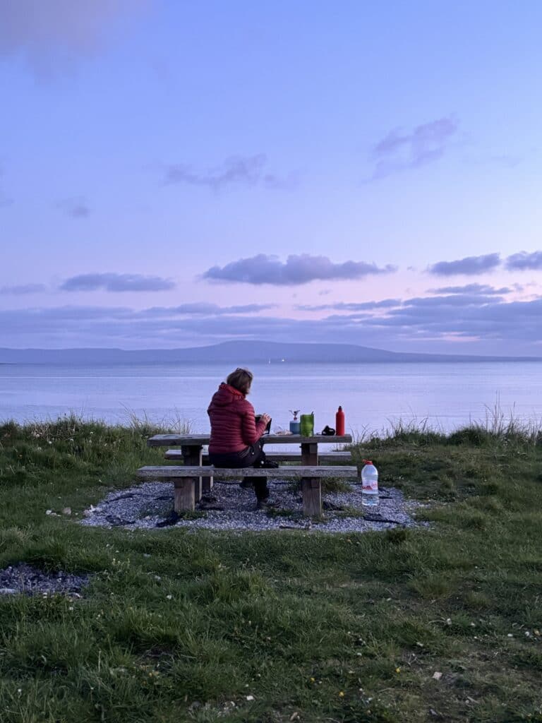
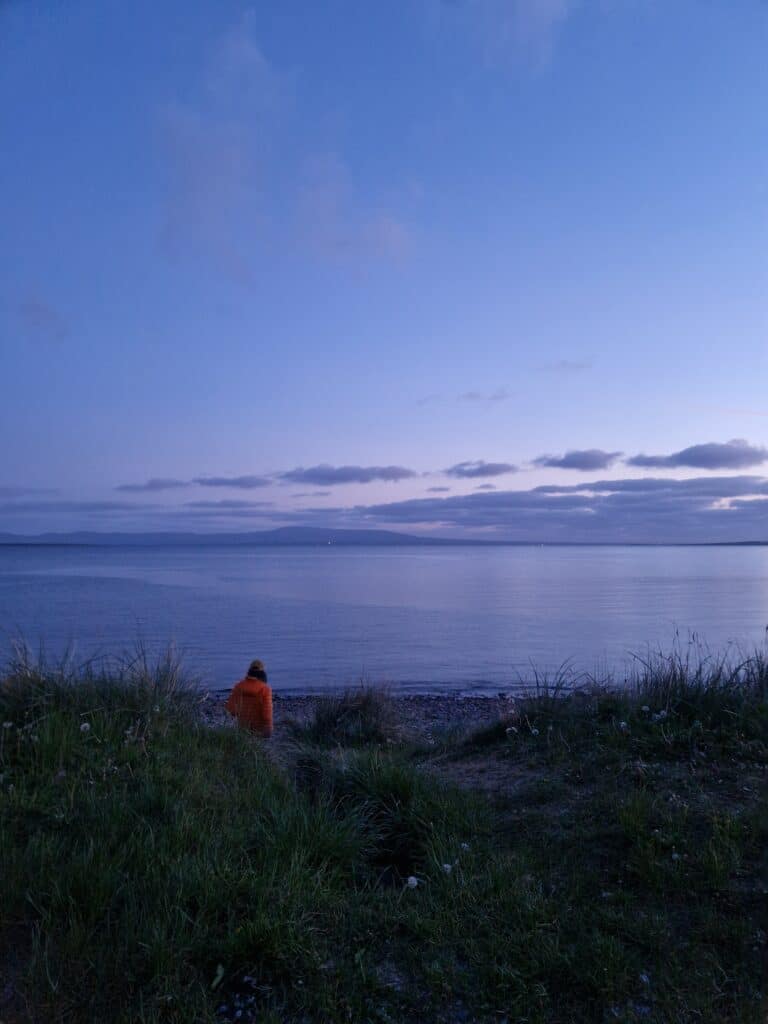
Once back at the car, we decided that climbing the other peaks would be quite similar and perhaps a bit monotonous, so we headed to the ocean for a walk along the cliffs instead.
Mount Errigal Hiking Map Details:
Day 2: Places to Visit in Ireland, Counties Donegal and Sligo
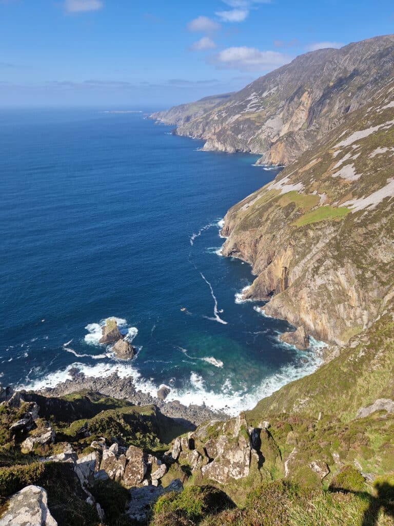
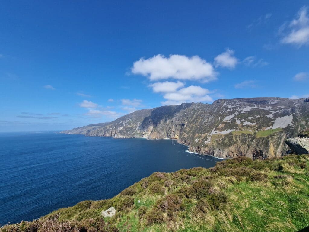
Irish Cliffs: Sliabh Liag (Slieve League)
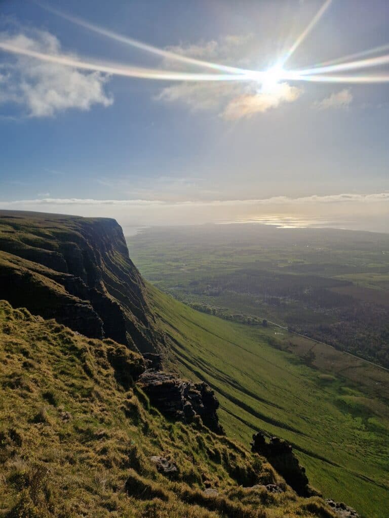
Ireland’s west coast is famous for its dramatic cliffs, jagged bays, and peninsulas. Sliabh Liag (Irish for “Mountain of Stone Slabs”) is one such natural wonder, rising over 600 meters above the Atlantic Ocean. These are some of the highest sea cliffs in Ireland—nearly three times higher than the popular Cliffs of Moher (which we decided to skip). Like the Seven Sisters, Sliabh Liag is located in County Donegal.
While this spot felt quite touristy to us, the experience was still great. The ice cream and coffee kiosks were put to good use as a pit stop while scrambling to the top of the rocks.
Parking: Slieve League – Lower Car Park. Paid parking: €15 for the whole day.
Sliabh Liag route map:
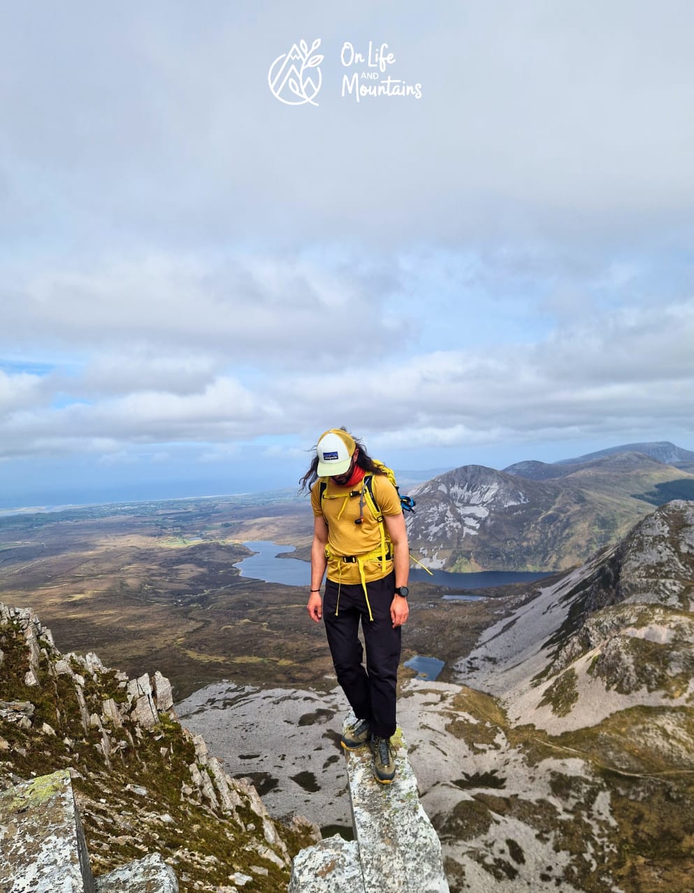
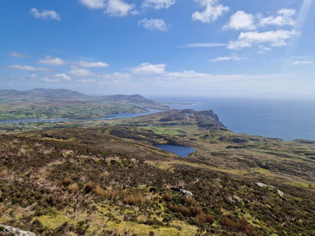
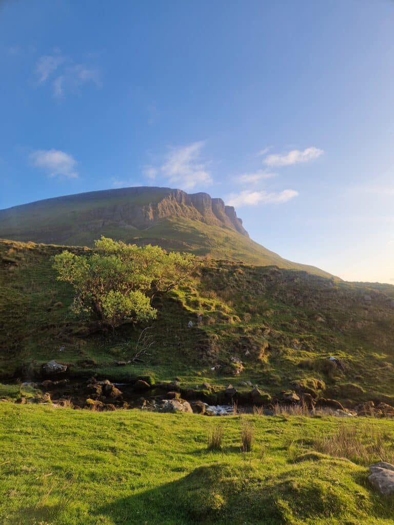
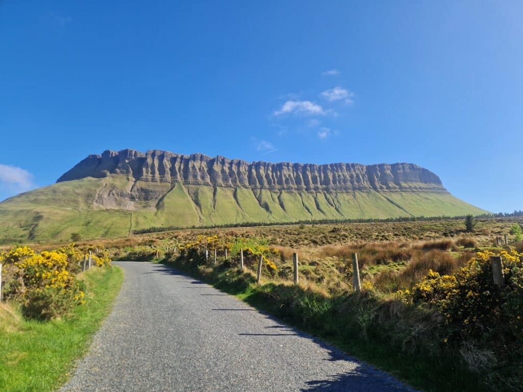
Climbing Mount Benbulben
Benbulbin (Irish for “Jaw Mountain”) caught my eye because of its very unusual shape, which somewhat reminded me of Mount Roraima in South America. Since Roraima is on my “must-visit” list, I decided to start with its smaller version in County Sligo.
We arrived at Benbulbin in the evening since we had visited Sliabh Liag earlier that day. We parked in the free parking lot near the mountain. Before we started gaining elevation, we had to cross a long meadow with several boggy patches. Because of this, I highly recommend waterproof hiking boots for this trek. I had read mixed reviews about the route, especially that the trail can become very slippery in the rain. However, the day turned out dry and beautiful for us, so we climbed quickly and enjoyed the unfolding expanses. Both the mountain and the climb were a fun adventure, and the views from the top were simply breathtaking!
Benbulbin route map:
Day 3: Places to Visit in Ireland, County Kerry
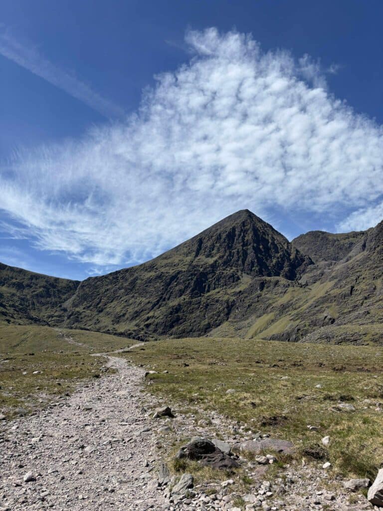
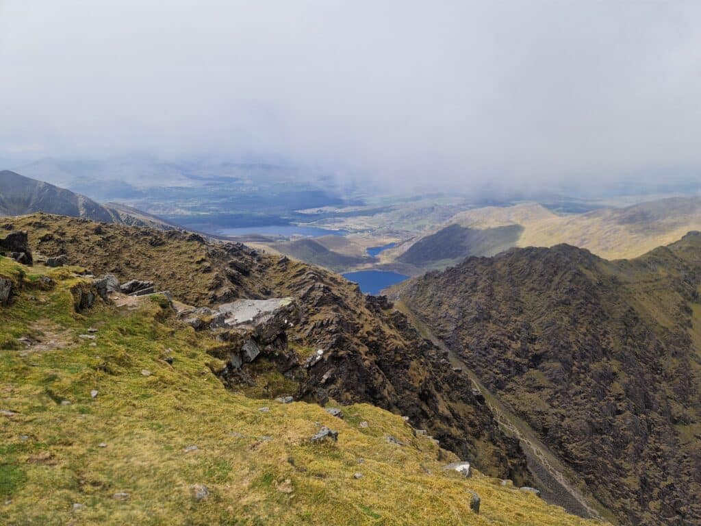
Ireland’s Highest Peak: Carrauntoohil
Carrauntoohil, located in County Kerry, is the highest peak in Ireland at 1,038 meters. The climb begins at Cronin’s Yard. This is a large facility with a massive parking lot—and a big lot is definitely needed because both campers and hikers were out in force. This mountain is extremely popular. All-day parking here costs €2.
The first stage of the hike leads through Hag’s Glen (Raganos slėnis). The path winds through green meadows and past small lakes, gradually gaining height. The views in the valley are impressive—the mountains aren’t massive in height, but their vibrant green is a treat for the eyes.
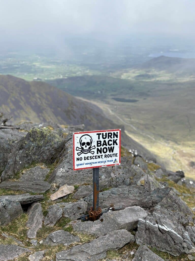
The real work begins in the second stage—a 300m vertical ascent up a steep gully known as The Devil’s Ladder (Velnio kopėčios). The path consists of steep rocks and loose stones, requiring many high steps and the occasional use of hands for balance. In the rain, these rocks can be very slippery, so caution is needed!
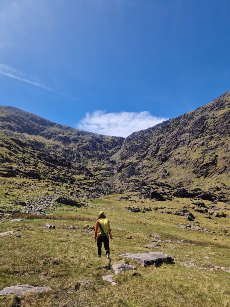
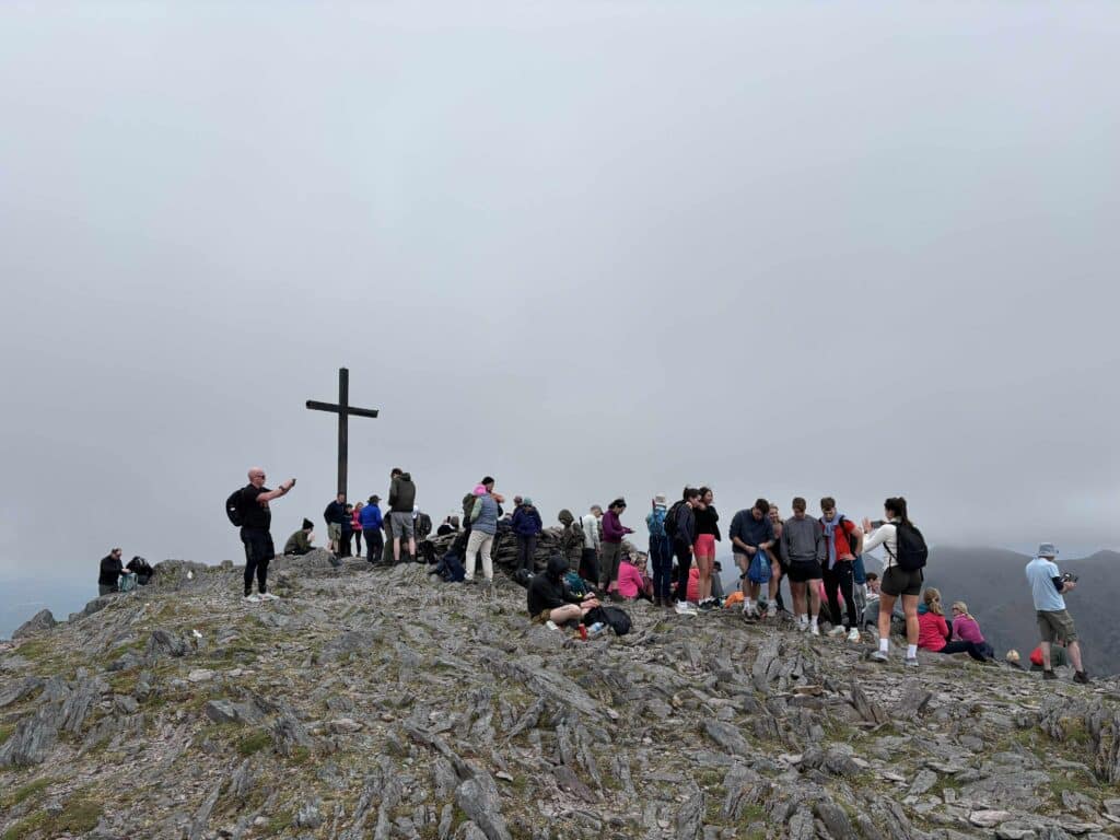
Having started our trek quite late, we climbed the Devil’s Ladder alone. However, once we topped out onto the ridge, we saw a crowd reminiscent of a busy beach resort! The mountain is truly popular. The third stage to the summit, marked by a cross, followed a wide path up the slope.
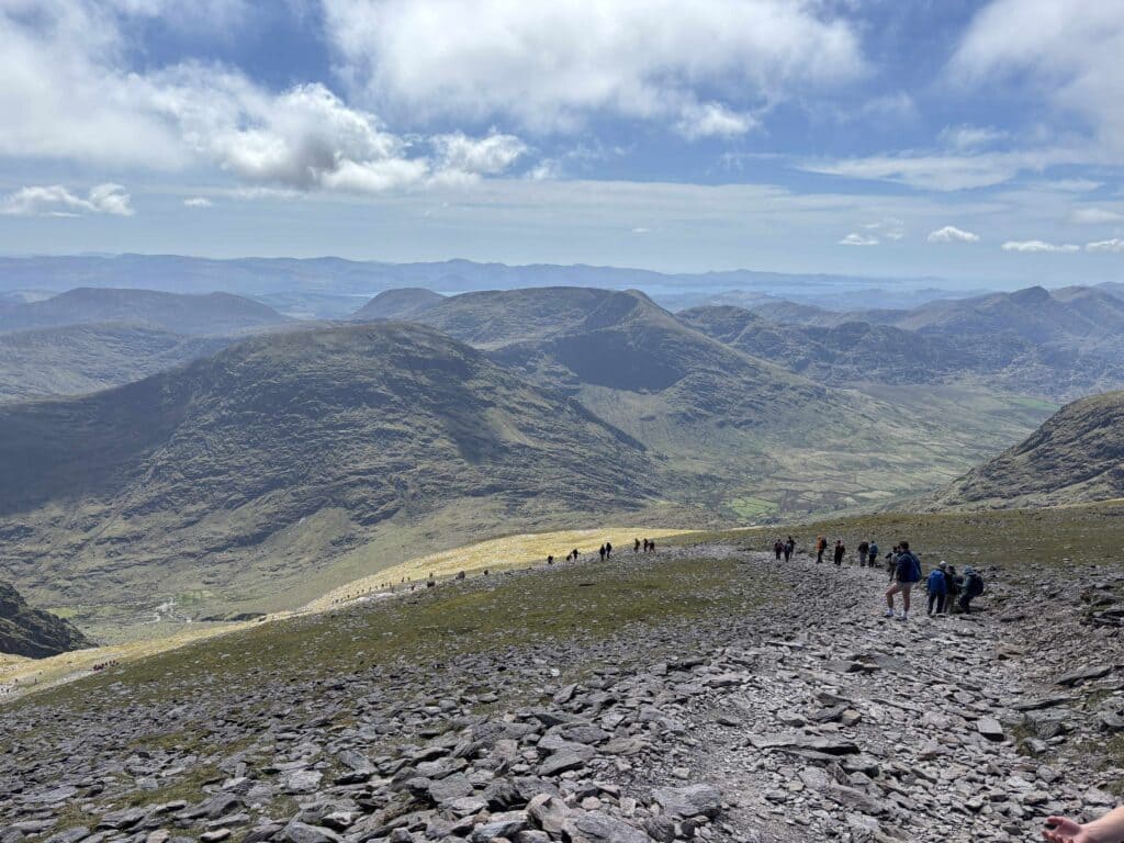
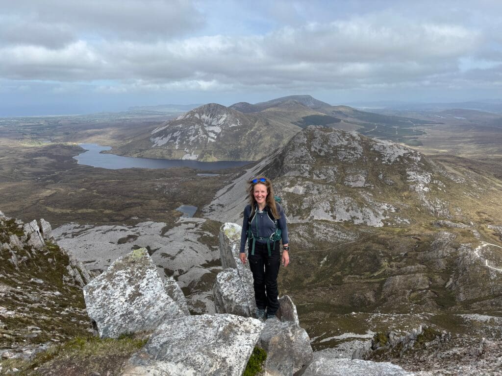
Not being particularly fond of the crowds, we decided to visit Ireland’s second-highest peak nearby—Beenkeragh (1,010m). A narrow and beautiful rocky ridge leads to it, which for me was the highlight of the entire hike. To our surprise, we didn’t meet a single person on Beenkeragh. For those looking for interesting, less-crowded routes, I highly recommend adding this peak to your list.
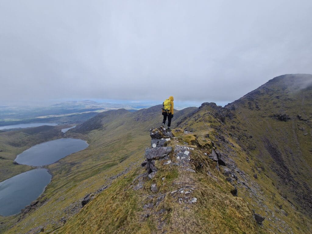
We descended via the other side of Beenkeragh, and on our way back to the car, we stopped at the bar in Cronin’s Yard for some well-deserved ice cream!
Interesting Fact: Over 80% of land in Ireland is privately owned, including Carrauntoohil. Unlike Scotland or Scandinavia, Ireland does not have a “Right to Roam.” Hikers only have access to these private mountains thanks to the goodwill of local farmers.
Carrauntoohil route map:
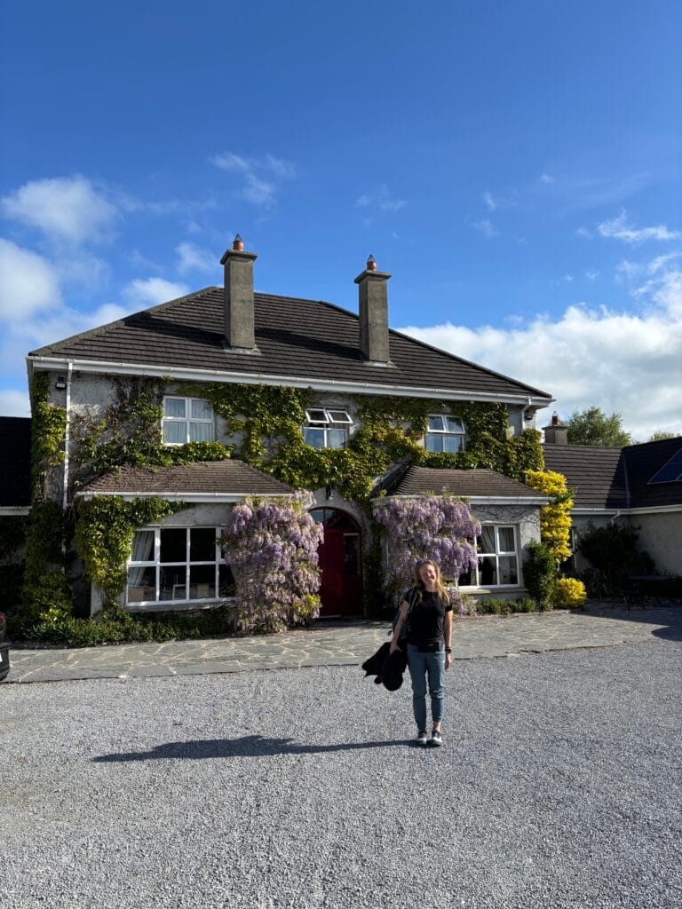
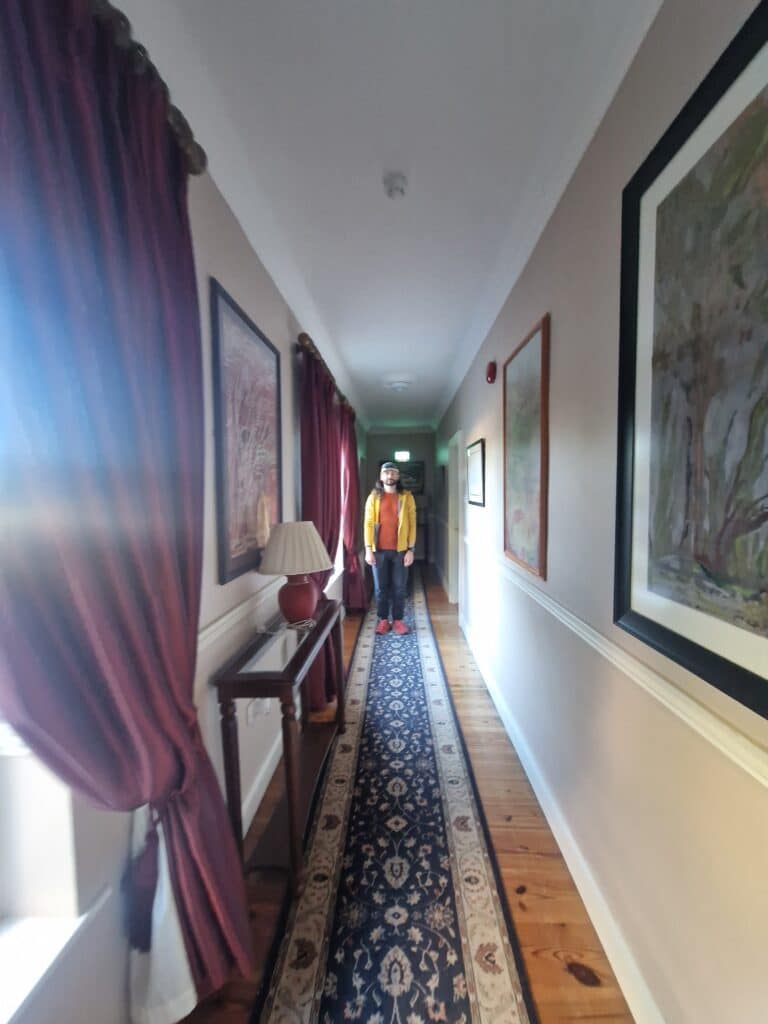
We decided to drive closer to Dublin to shorten the next day’s journey. We stayed in the town of Adare at the Adare Country House apartments. We were welcomed by the incredibly friendly owner, Eileen. She was expecting us, had remembered our names, shook our hands, and told us about a Lithuanian man named Andrius who stays with her often (she even asked if we knew him! :D). After a short chat, she showed us our cozy room. We felt so incredibly welcomed in such a beautiful home!
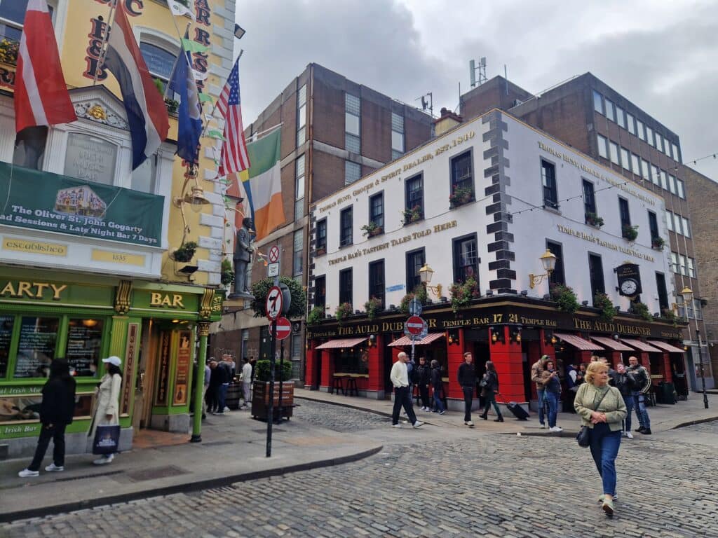
Day 4: The Capital of Ireland, Dublin
We aren’t massive city fans, so we didn’t dedicate much time to Dublin on our four-day trip. We walked around the Old Town for a few hours, grabbed a bite to eat, enjoyed one last pint of Guinness, and headed toward the airport to return the car. We felt happy and refreshed—emerald Ireland is an incredibly beautiful country!
Have you visited Ireland too? Share your impressions and favorite places in the comments!
In Life and Mountains